Wild Rose Tour

Wild Rose Tour: Coleman → Calgary

This is part seven of a seven part series about my trip around Alberta.

As if it were a sign, the morning of my last day was rainy and cold. The transition to fall began.

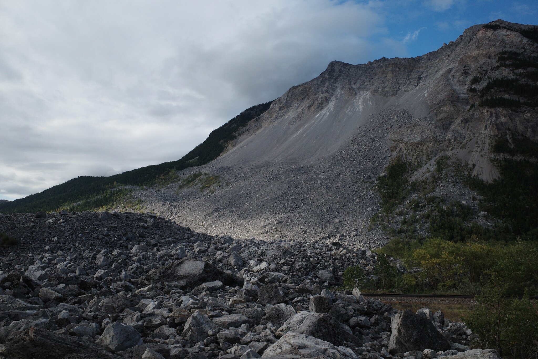
I stopped by Frank Slide first and once again felt the presence of a town that should be there, but isn’t. Further up the road was Leitch Collieries which was much more interesting than I thought it would be. I nearly skipped it but I’m glad I didn’t. The site has an interpretive walking path that steps in and out of old coal mining facilities. Unfortunately, the only cash I had on me was a $20 bill and I didn’t want to donate all of it, despite the fact that I should’ve. I owe you one Leitch Collieries.

Leitch Colleries.jpeg

The final, final stop of the trip was Lundbreck Falls which, despite the early hour, was packed with people.

Lunbreck Falls.jpeg

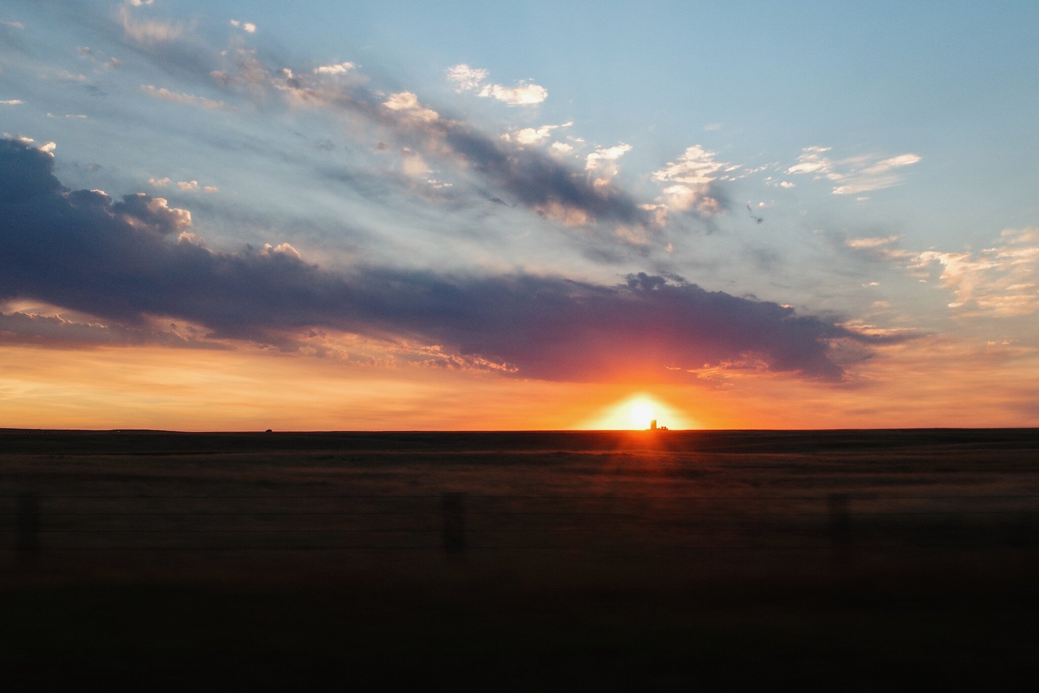
The drive home along Cowboy Trail was uneventful with low clouds. The southern portion is nestled between many hills. Vast, flat areas leading to slow elevation gain in the distance. It rained off and on. Sometimes a mist, other times with droplets.

Cowboy Trail.jpeg

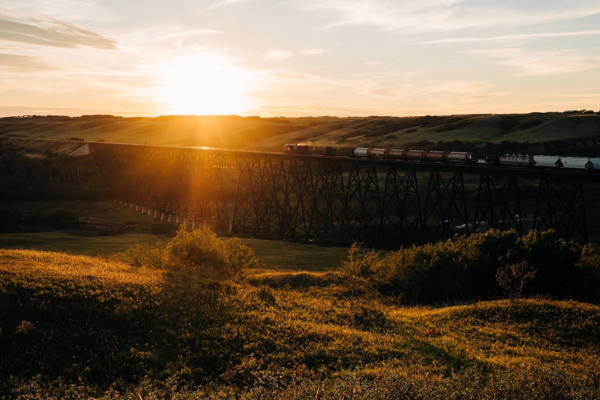
I arrived back in Calgary, finally having felt like I had seen this province and all its beauty.

For more photos from the trip, check out the companion gallery.

Equipment notes

The Wild Rose Tour was completed in a 2019 Honda Fit. Photos were taken with a Ricoh GR III, iPhone 11 Pro, and DJI Spark. Journal entries were written in Apple Notes. GPS recordings are from Gaia GPS. Check out the companion Wild Rose Tour road trip playlist on Apple Music.

This is part seven of a seven part series about my trip around Alberta.

Wild Rose Tour: Medicine Hat → Coleman

This is part six of a seven part series about my trip around Alberta.

September 6 began with Etzikom, a town name I never learned how to say properly. There was a windmill museum there, but I saw different windmills on the way—the beautiful ones generating wind power. I drove along dirt roads to get as close as I could to one and ended up finding an abandoned home too. The sun and heat were intense here with Days of Heaven vibes.

Days of Heaven.jpeg
Windmills.jpeg

Along the way to Lethbridge I saw more Pronghorn Antelope with the funny coat and horns. They were running and jumping across the highway. Further up, I could see a dead one at the side of the road. Once big and free, and now a mass of flesh and bone with the life gone from it. I thought about stopping to make sure it was indeed dead and not suffering, but then a strange scene from the film Princess Mononoke came to mind. The one where the dead wolf’s head jumps up to bite Lady Eboshi’s arm off. I drove by.

I hadn’t seen this side of Lethbridge before (literally and figuratively) and the calibre of Henderson Lake Park was something out of much larger city. It’s a big lake surrounded by gardens and pools. I desperately wanted to get into the water park to cool off. Alas, the pandemic, no swim shorts, and the fact that I am a solo grown man with no kids convinced me otherwise. Off to the Japanese garden instead. I heard Japanese for the first time in a long time and the whole tour around the well-maintained garden transported me back to the country.

Japanese Garden.jpeg
Origami.jpeg

I made a brief stop at Cardston to see the Mormon temple. My trips to Salt Lake City for work have given me an appreciation for these temples in the same way someone might visit a cathedral in Europe or a mosque in Morocco.

Cardston.jpeg

However, the true destination today was Waterton. Along the way I thought I was looking at the Montana hills, but then I realized they were the mountains in the distance. The extreme haze made it difficult to tell. Once I stepped outside I realized the haze was in fact smoke. Despite this, Waterton was beautiful and the smoke added extra depth to the photos. I drove up and down the Red Canyon scenic drive. Unlike the deserted tourist sites of Jasper and the surrounding area, the parking/hiking area in Waterton was full. No trail run today.

Waterton.jpeg

The drive continued through the windmills at Pincher Creek on onto Highway 3 toward Crowsnest Pass. The smoke was getting thicker now. Always chills at Frank Slide. It’s hard to believe a whole town is buried under all that rubble when Turtle Mountain split in two and covered everything and everyone in minutes.

Frank Slide.jpeg

Tonight’s stay was in Coleman and after dropping my things off at a small motel I walked to ‘Old’ Coleman and waited for my restaurant reservation. Dinner was vegetable samosa with cranberry chutney, mushroom ravioli, and grilled veggies with whipped goat butter. It was dark by the time I was finished which meant walking home along the highway through a smoky old mountain town.

Coleman Sunset.jpeg
Coleman Night.jpeg
Motel.jpeg

This is part six of a seven part series about my trip around Alberta. Check out the next part.

Wild Rose Tour: Wainwright → Medicine Hat

This is part five of a seven part series about my trip around Alberta.

It was a stunner of a day, perhaps the best day of the trip. Summer’s last hurrah before letting winter take over. I had finally found the rhythm of the trip: wake up, get ready, drive, picnic, run, rest, find the hotel, write, sleep. I had a long drive ahead, but I was looking forward to this one.

I saw the trains as I left Wainwright and thought of mum falling asleep to their sounds. I think it’s like my attraction to the highway echo. Not the inner city highway echo I have now, but the echo of a highway in the distance. Growing up on (what was then) the outskirts of town, highway echoing into empty air with the next city hundreds of kilometres away.

The harsh sun directly overhead made for crispy grass in the fields. The province was getting flatter now; also yellower, drier, and hotter. I stopped in the ghost town of Rowley. It wasn’t long before I came across a nice picnic spot in front of three old grain elevators. Across the street was a barn that was 100% haunted.

Grain Elevator Picnic.jpeg

Driving south on Highway 839 was beautiful. It’s the rolling hills style of Alberta that I love. A mix of green and yellow with small bushes and the odd tree. Ponds everywhere.

Green and Yellow.jpeg

I passed by Bleriot Ferry although a crossing wasn’t necessary today. The west side of the Red Deer River was where I needed to be. It was a pretty looking ferry, and more Covid-official than the Klondyke Ferry was a few days ago. Up the road was Orkney Viewpoint which lived up to dad’s sales pitch.

Bleriot Ferry.jpeg

The badlands were wonderful as always. They are otherworldly, but an antipode to the otherworldliness of the Columbia Icefields. Dinosaur Provincial Park was up next. I made a brief stop at the top of the valley and stared into the bowl. I hadn’t planned to run here, but now it felt like something I needed to do.

The trail was energizing and reminded me why I love to run. Since my running has been focused on goals, getting faster, improving form, etc., I had nearly forgotten the pure joy I get from moving through the world at a relaxed pace. These extra kilometres were an opportunity to run free. I did some off-roading and then found an interpretive trail that felt an awful lot like running on the set of The Lion King.

Dinosaur Provincial Park.jpeg

Back up to the top of the valley I had a chips and guacamole snack break. In an extra special gesture, I had the one remaining can of pop I had been saving for the right moment. Now felt like the right time.

Snack Time.jpeg

It was a well timed snack because my makeshift refrigerator in the trunk was failing. It had been a few nights without a hotel freezer and the ice packs hadn’t been able to cool down enough.

Makeshift Fridge.jpg

I said goodbye to the provincial park and drove to Medicine Hat. Golden hour was imminent. I took another car selfie along the way and marvelled at the sun setting to the west of me. The hills were rolling which gifted me 10, maybe 15, sunsets in one night. The sun would dip behind a long hill, then reappear later on as the hill mellowed out.

Car Selfie 2.jpeg
Multiple Sunsets.jpeg

Turned onto the TCH for the last big stretch of the day’s drive. Streetlights, headlights, and taillights smeared by. The city lights in the distance looking like a galaxy of stars. Medicine Hat is a hot city, and it has that hot-city-at-night smell that I love dearly. A combination of restaurant food, A/C, exhaust, pavement, rubber, earth, and other things that are more than the sum of its parts. I’m not doing a good job selling it, but it’s emblematic of a hot summer and nights that shouldn’t end.

The hotel was the nicest I’d ever stayed in. I was overjoyed to see a freezer for my ice packs. I snacked, watched the hotel TV (which had a welcome channel customized with my name), caught up on messages, sorted photos, and wrote. Yep, I had found the rhythm of this trip.

This is part five of a seven part series about my trip around Alberta. Check out the next part.

Wild Rose Tour: Edmonton → Wainwright

This is part four of a seven part series about my trip around Alberta.

Sunny today with little cloud cover. It was time to visit the hot, dry part of Alberta. But first, a few quick pitstops along the way: Redwater with its giant, red oil derrick, Waskatenau with its trestle bridge, and Smoky Lake with its giant pumpkins.

I spent the afternoon in the Metis Crossing and Victoria Settlement area. I drove down Alberta’s oldest paved road still in use and saw an old man walking four dogs of various ages. I received two waves from the man for slowing to a crawl and not hitting his dogs. It was clear they were all loved dearly—especially the slow, old one who wagged his tail with the vigour of a pup.

Victoria Trail.jpeg

Victoria Settlement was thoroughly closed with not even a security guard in sight. I changed into my running gear and ran, ran, ran. It was 24 x 200m sprints today. Straight out to Metis Crossing and back. Something clicked in me as I was running: I’ve been thinking about this disconnect between the capabilities of the body and the moment when the mind starts to put the brakes on. But as I ran today there was an obviousness of “run through it”. The mind will tell you to stop because it’s painful, but that’s a thought like any other. The body will perform fine. The mind is holding it back.

Back at the car I grabbed food, found a nice spot on the grass, and had a lovely (if lonely) picnic under big trees and amongst historical buildings. Took far too many selfies trying to find a flattering post-run look.

Picnic 1.jpeg
Picnic 2.jpeg

The remaining drive felt like classic prairies with yellow-green fields and large bales of hay rolled up.

Wheaties.jpeg

In Vermillion I stopped at an A&W for dinner and much to my surprise, Siri took me to the one right beside a hotel I stayed at a few years ago.

A&W.jpeg

With Beyond Burger in belly, I made my way to the final destination for the day: my mum’s hometown of Wainwright. I opened the blinds in the Wainwright hotel room and laughed at the building across the street: another A&W. I dropped my backpack off and headed right back out the door to watch the sun set behind a big trestle bridge outside town.

Wainwright Sunset 1.jpeg
Wainwright Sunset 2.jpeg
Wainwright Sunset 3.jpeg

This is part four of a seven part series about my trip around Alberta. Check out the next part.

Wild Rose Tour: Peace River → Edmonton

This is part three of a seven part series about my trip around Alberta.

All types of clouds today: overcast, fluffy, feathered bottoms, soft tops, and the rainy varieties. The prairies lend themselves to skyscapes.

I left Peace River by coming up and out of another valley. Pretty typical prairie views leaving Peace River, but as I got closer to High Prairie the trees started lining the road. There was a nice little town named McLennan that had bird silhouettes on all their lampposts. I turned onto Grizzly Trail and had the whole stretch of road to myself, save one camper van.

Grizzly Trail.jpeg

The ferry near Fort Assiniboine and the subsequent ferry ride were fantastic. It’s a wonder this thing operates when a bridge would do. It’s undoubtedly a relic from a different time, but I’m glad it’s here. The rest of the drive to Edmonton was uneventful. More 80s jams with a few podcasts mixed in.

Klondyke Ferry.jpeg

Today’s big event was the run through Edmonton’s river valley and it was pure bliss down in that forest. The recent rain left puddles for jumping and wet air for breathing. I was running fast with a smile on my face the whole time.

River Valley.jpeg

My dinner for one looked like dinner for two, and the two sets of cutlery in the takeout bag all but confirmed it. Gnocchi with gorgonzola sauce, an arugula salad with beets and goat cheese, more bread, and Italian donut bites with a hazelnut spread for dessert. Superb.

Mustered up my last bit of energy to do laundry in the sink and then fell asleep before my head hit the pillow.

This is part three of a seven part series about my trip around Alberta. Check out the next part.

Wild Rose Tour: Jasper → Peace River

This is part two of a seven part series about my trip around Alberta.

The drive out of Jasper started overcast and drizzly but it wasn’t long before I saw the “Scenic Route to Alaska” sign and made the big lefthand turn onto Highway 40. The clouds parted, the traffic thinned, and Neil Diamond’s Sweet Caroline started playing. The road was an endless climb with endless trees and I couldn’t shake the feeling I was driving through one of Earth’s lungs. Boreal forest as far as the eye could see.

Jasper Outskirts.jpeg

I stopped for lunch at Grand Cache Lake and what followed was the worst catastrophe in the history of sandwich preparation. This lake was surrounded by gale-force winds, but I was stubborn and determined to make my sunflower butter and jam sandwich on the picnic table. Nature had other plans. So here lies a brief catalogue of the tragedies. The sunflower butter lid flew away. Both bread slices were almost airborne at all times. One slice achieved minor liftoff and slapped—toppings side up—the side of the jam jar. Lastly, the surface of the bread was nearly dried out completely from the wind sucking the moisture away. And despite all this, I made and ate my goddamn sandwich in a hurricane. 10/10 would recommend.

Grand Cache Lake.jpeg

The drive through Grande Cache was pleasant! It sits up high on a hill with a main road leading down a long way. It feels like the ocean should be at the bottom of that hill, but it isn’t, so that stops it from feeling like a seaside town. Small homes, lots of outdoor equipment, and every second person owns a large RV.

After Grande Cache I entered oil and coal country. This was an organized operation. The construction zones started, well pads to my left and right, and many stoppages along the way. The cars turned to trucks, and the trucks turned to semis. A collage of fresh asphalt, pylons, and reflective vests ahead of me. Past that, I was on my way to Grande Prairie which felt like the engine room of the province with its mix of oil and gas, agriculture, and forestry industries.

As soon as I dropped into the first valley outside Grande Prairie I emerged in the Peace Region. A pretty name for an equally pretty place. I crossed a large bridge and came out of the valley to more fields and golden light. I rode this high into Peace River which is a quiet—and dare I say, peaceful—town. I dropped off my bags at the Sawridge Inn and ran down to the river to stretch the legs before settling in for the night.

Dollar Store.jpeg
Peace River.jpeg

This is part two of a seven part series about my trip around Alberta. Check out the next part.